


Add heading
ZenduMaps is a MyGeotab add-in that allows users to create public, shareable links which display vehicle location, trips, and exceptions for specific time periods.
Key Features of ZenduMaps
Add Description
Make Edits on the Fly
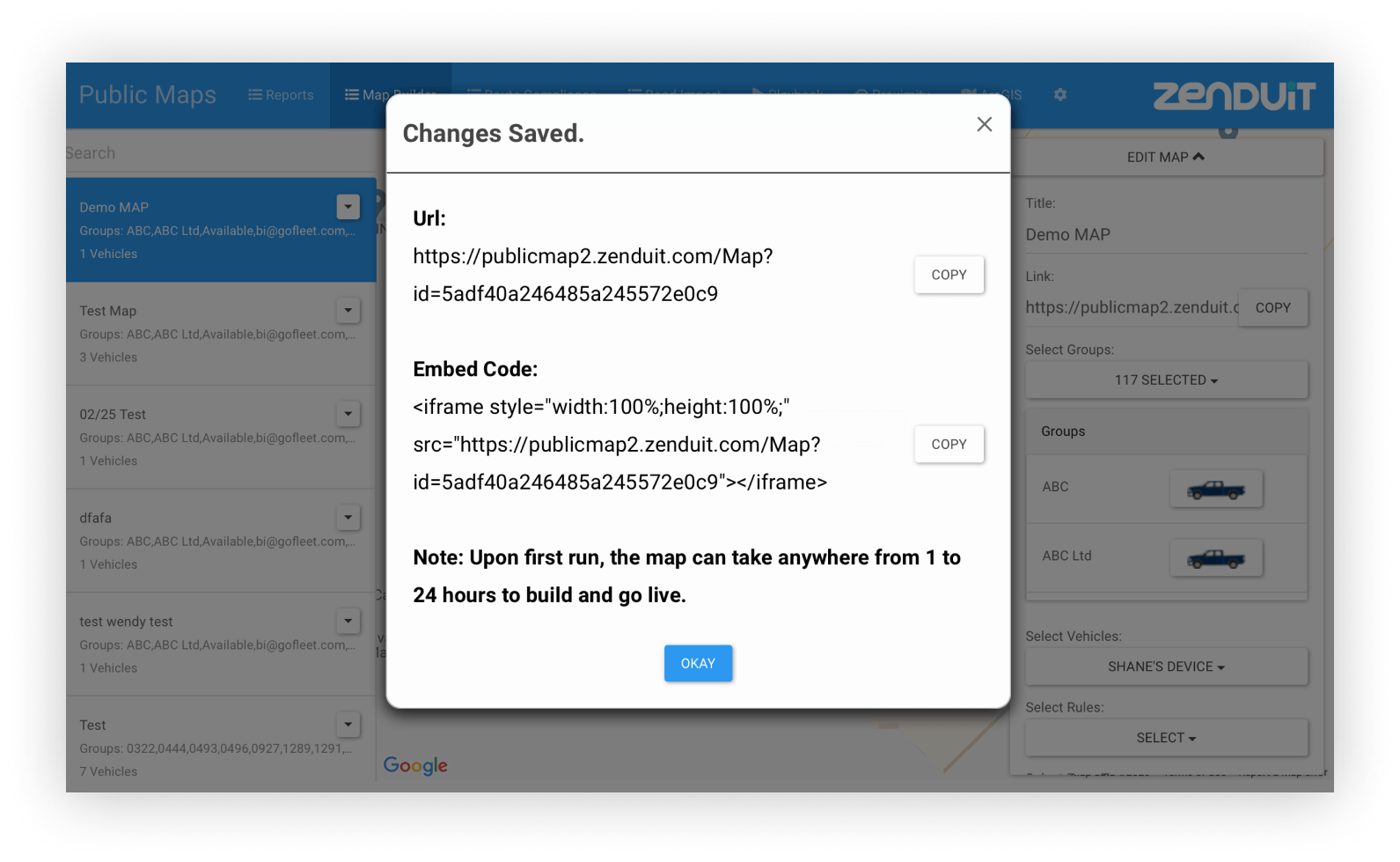
When you change settings to your map, they are updated in real-time. No need to administer a new URL to your users.
Embeded or Independent
Your maps automatically generate a unique URL and embed code, so you can decide how your map is displayed. Use your Public Map as a standalone site, or incorporate it to an existing web-page.

Colour-Coded Compliance
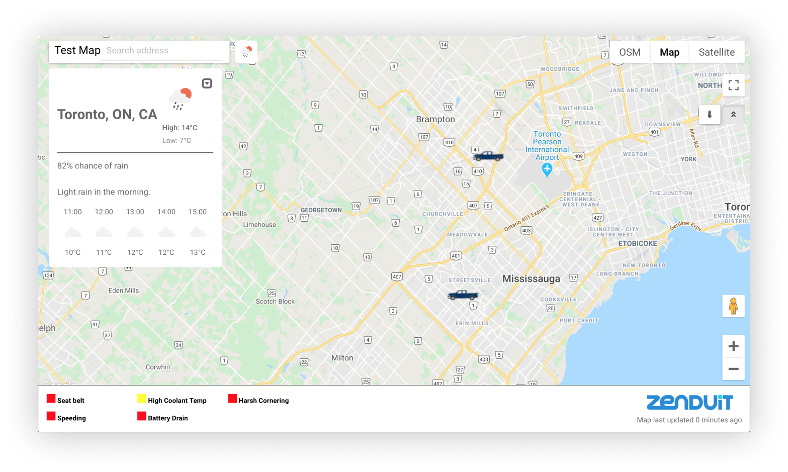
Show when certain road events happened live on the map. Great for showing your users when roads have last been plowed or salted during the winter.
Tons of Visualization Elements
Choose from 125 icons for each vehicle, add a map legend, or even add a weather widget. Whatever it is, Public Map Share lets you customize your map to show users exactly what you want.
Custom Dashboard With Custom Widgets
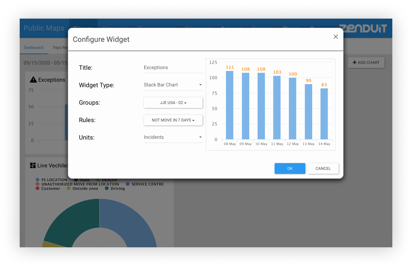
Choose what data you’d like to see at a glance. With many graph types and rules, you can make your dashboard your own.
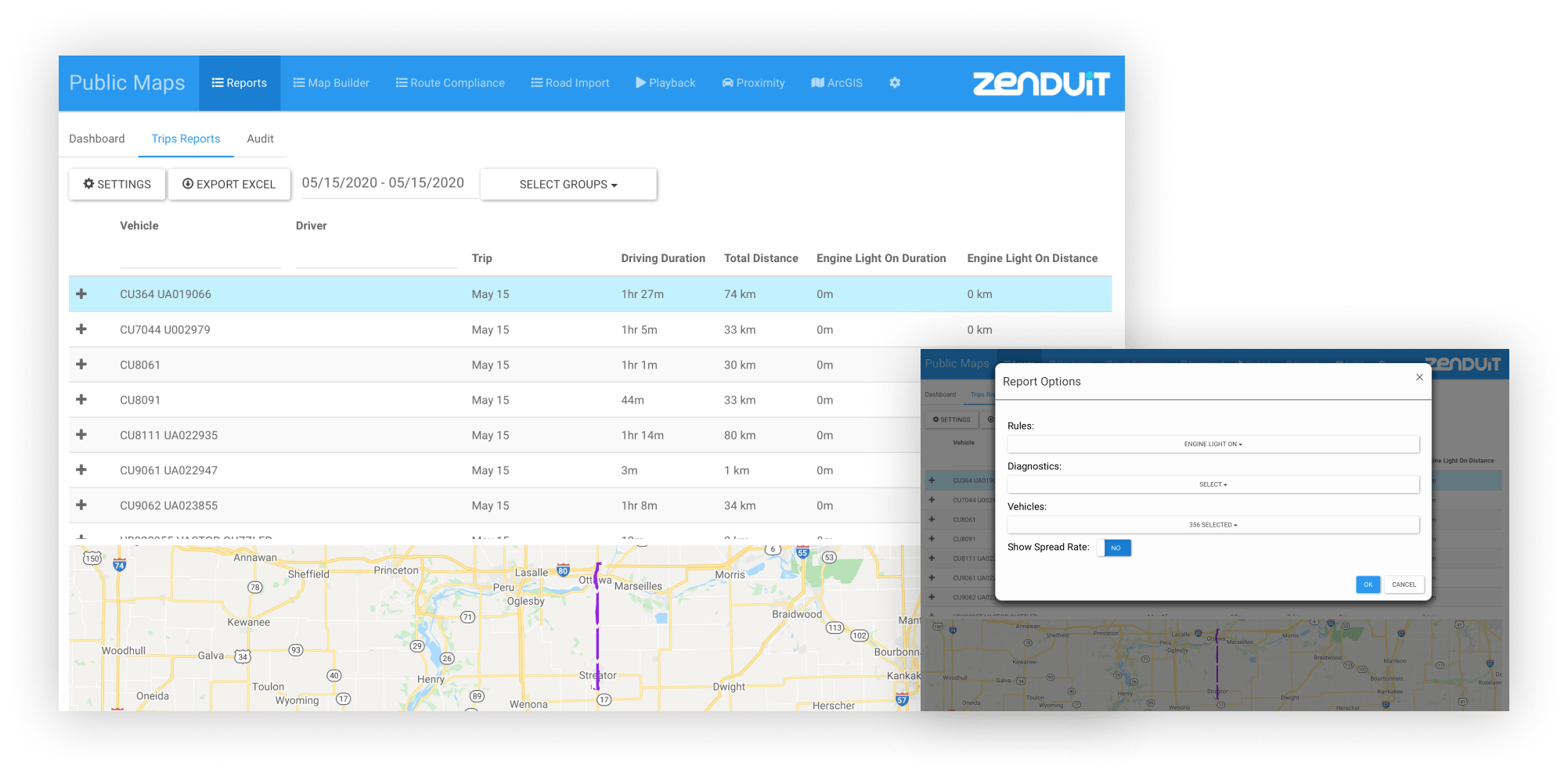
Detailed Trip Reporting
Track the rules, diagnostics, and vehicles you care about with trip reporting. Selecting a trip displays a mini-map so you can better understand your fleet’s operations.
Technical Features
Add Section description
Add Section name
Add Item name